Leeds snow: This is when heavy snow is set to hit Leeds this week - full weather forecast
and live on Freeview channel 276
The Met Office warning is in place from Monday, February 1 until Tuesday, February 2.
Snow and widespread ice is likely to push slowly northeast during Tuesday, bringing difficult travel conditions, the Met Office said.
When is it going to snow in Leeds?
Advertisement
Hide AdAdvertisement
Hide Ad

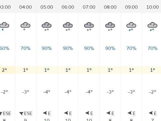
Light snow will begin to fall on Tuesday morning at about 4am, turning to several hours of heavy snowfall between 5am and 7am.
At around 8-9am the snow may give way to sleet, according to the latest Met Office forecast for Leeds.
Then a mix of rain and sleet will fall throughout Tuesday.
It means that high ground areas of Leeds could again be facing lots of snow and disruption should the forecast prove accurate.
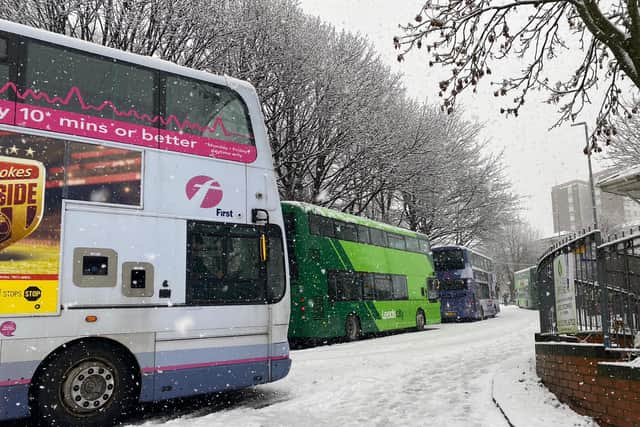
The Met Office warned people to expect travel delays, public transport cancellations and potential power cuts.
Full weather forecast by the Met Office.
Monday
Advertisement
Hide AdAdvertisement
Hide AdIt will be a cold and frosty start to the day in Leeds on Monday.
The sunshine will then come through and the day will be dry.
Despite the sunshine and light winds it will be staying on the cold side.
The maximum temperature will be 6 °C.
The evening will be dry before rain arrives from the west overnight.
Advertisement
Hide AdAdvertisement
Hide AdThe rain turning to snow on its leading edge, even to low levels.
Some significant accumulations are likely on hills.
The minimum temperature will be 0 °C.
Tuesday
Tuesday will be cold and windy, with further sleet and snow first thing,
Heavy snow will begin at 5am until 10am.
It will then begin to rain heavily.
It will turn showery and less cold from the south during the afternoon.
The winds will ease.
it will begin to sleet from 9pm.
The maximum temperature 2 °C.
Outlook for Wednesday to Friday:
Rain and hill snow persisting in the north on Wednesday and Thursday, but generally brighter and showery to the south.
It will be less cold.